Aerial Mapping with Drones: Precision, Speed, and Safety in Modern Engineering
In industrial, construction, and power plant projects, accurate land surveying is a cornerstone of design, execution, and monitoring. Aseman-Rasad Hadi, equipped with advanced drones and a professional team, provides aerial mapping services with the highest accuracy and quality—a method that offers significant advantages in speed, safety, coverage, and cost compared to traditional ground surveying.
What Is Aerial Mapping?
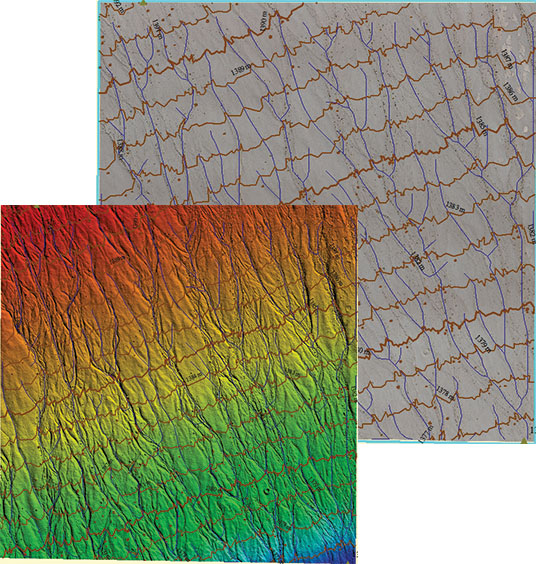
Aerial mapping with drones is a process in which drones equipped with high-resolution cameras and GNSS/RTK positioning systems fly over the target area and capture high-resolution aerial images. These images are then processed using specialized software to generate outputs such as:
- Digital Surface and Terrain Models (DSM/DTM)
- Topographic maps and contour lines
- Geo-referenced orthophotos
- 3D models of terrain and structures
These outputs are essential for project design, analysis, and documentation.
Advantages of Aerial Mapping Compared to Ground Surveying
1. High Speed
Large-scale projects that may take days or weeks with ground surveying can be completed in just a few hours with drones.
2. Complete and Uniform Coverage
Drones provide consistent coverage across the entire site, including hard-to-reach, steep, or hazardous areas inaccessible to ground surveyors.
3. Enhanced Safety
In projects such as solar plants, refineries, or mines, human presence may involve risks. Aerial mapping eliminates the need for physical presence, ensuring team safety.
4. High Accuracy
With RTK-equipped drones and advanced image processing software, aerial mapping achieves centimeter-level accuracy—fully reliable for engineering design, volumetric calculations, and project progress control.
5. Visual Documentation
Outputs such as orthophotos and 3D models are not only technically useful but also highly effective for reporting, documentation, and presentation to clients or regulatory authorities.
Applications in Solar and Industrial Projects
In solar power plant projects, aerial mapping plays a key role at different stages:
- Pre-installation: Assessing topography, land slope, natural obstacles, and panel layout design
- During execution: Monitoring project progress, controlling excavation volumes, and precise structure placement
- Post-installation: Final documentation, verifying execution against design, and preparing handover maps
In industrial projects such as refineries, mines, transmission lines, and infrastructure facilities, aerial mapping enables fast and accurate monitoring.
Our Experience in Major Projects
Aseman-Rasad Hadi has successfully executed aerial mapping in landmark projects, including:
- Large-scale solar power plants and SATBA solar projects
- Industrial and mining facilities across various provinces
- Large-scale construction and infrastructure projects
This track record has earned the trust of major clients and established us as a specialized reference in this field.
Why Aseman-Rasad Hadi?
- Use of professional drones equipped with RTK and high-resolution cameras
- Expert team in image processing and engineering map production
- Practical experience in industrial, power plant, and construction projects
- Documented technical reports suitable for submission to regulatory authorities
- Compliance with legal requirements and official drone operation license from the Civil Aviation Organization for aerial mapping
For expert consultation, service booking, or sample maps, contact us. We are here to elevate your project with precision, speed, and safety.