
In recent years, due to the rising cost of fuel on one hand and environmental damages on the other, the global demand for renewable energy has significantly increased. Among renewable power plants, solar and wind farms have received greater attention from countries compared to other types.
Mapping these power plants, given the relatively large land areas required for their construction, is not economically feasible using traditional ground surveying methods. The use of drones for such mapping provides higher accuracy, faster results, and far more diverse outputs compared to ground surveying.
Mapping Services of Aseman Rasad Hadi Company for Solar and Wind Farms
A) Solar Power Plants
- Preparation of high-accuracy, high-resolution topographic maps
- Preparation of orthomosaic maps compatible with AutoCAD software
- Preparation of Digital Surface Models (DSM) compatible with ArcGIS, Global Mapper, and similar software
- Preparation of KML files compatible with Google Earth, available offline with desired resolution
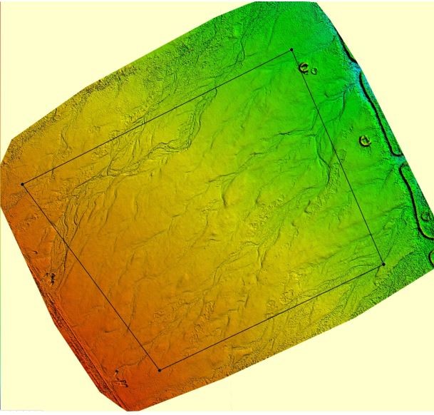
In 2016, Aseman Rasad Hadi Company conducted aerial mapping of a 10 MW solar power plant located in Yazd. Various outputs of this project are available below (note: the original photo quality is much higher than what is displayed on the website).
The client of this aerial mapping project was the German company Kronos Solar.
- Orthomosaic map
- Digital Surface Model (DSM)
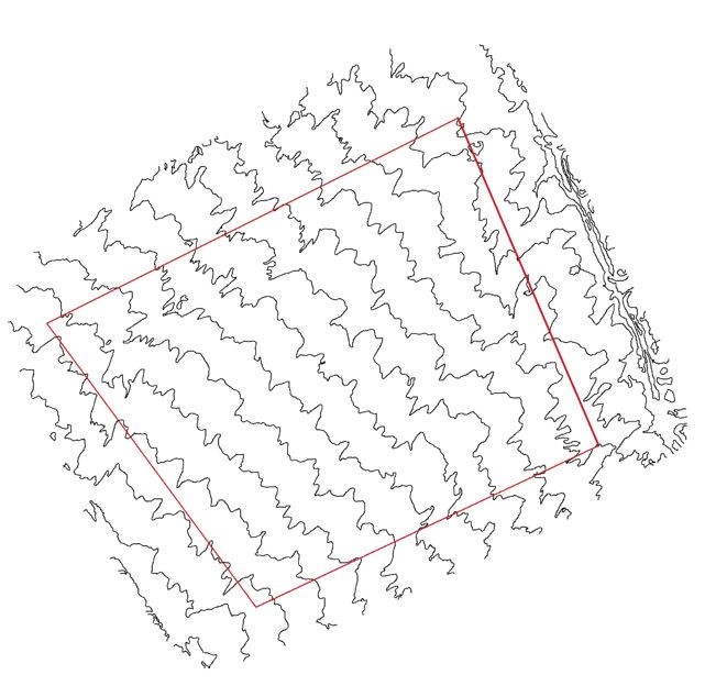
- Topographic map of the power plant site
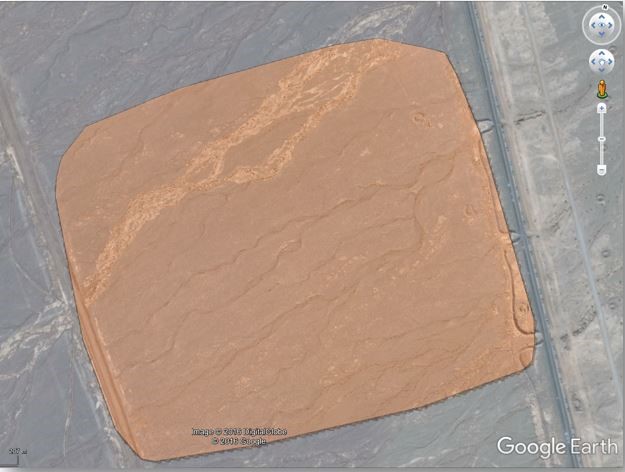
Google Earth layer of the site (with very high resolution in the original file)
B) Wind Power Plants
Wind farms, due to their vast land areas, are also prime candidates for aerial mapping. All of the above-mentioned services (for solar power plants) can also be provided by Aseman Rasad Hadi Company for wind farms.
Another application of aerial mapping for wind farms is the preparation of topographic maps and 3D terrain models for use in specialized wind farm analysis software such as WindPro. It should be noted that terrain features and roughness have a significant impact on the wind patterns at the site of a wind farm. Therefore, accurate modeling of these features increases the precision of WindPro analyses.
Aseman Rasad Hadi Company is capable of preparing such maps in SHAPE format, which is directly importable into WindPro software.